

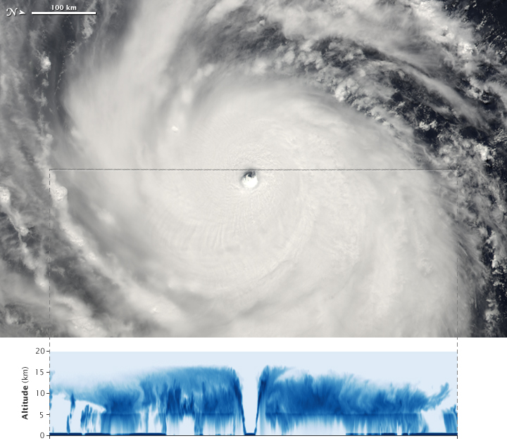
The image depicts Super Typhoon Choi-Wan. The top image was taken by MODIS on Aqua while the lower image shows data taken by a different A-train satellite.
- Name the satellite and instrument which took the lower image. (Hint: it's one of the satellites with a focus on cloud profiling)
- It is apparent from the lower image that whatever satellite took the image was able to collect data fairly deep into the clouds. If the other satellite with a focus on cloud profiling took the lower image, would it also be able to collect data from within the clouds, or would it only detect the very highest portions of the clouds? Why or why not?
- Explain the effects of clouds on radiation coming from above (solar radiation) and radiation coming from below (infrared emitted from the ground) and the implications for Earth's overall energy balance.

